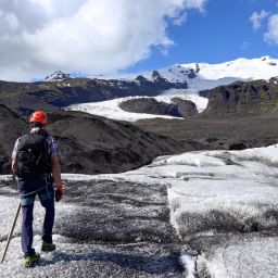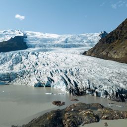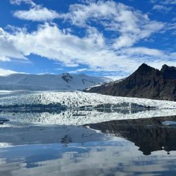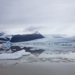
Vatnajökull National Park is the largest of Iceland’s three waterfalls. It encompasses a vast area of 14,967 km², the equivalent of about 14% of the country. Much of it is dominated by the massive Vatnajökull glacier, but at its fringes lie gorgeous waterfalls that punctuate remote rivers and plunge into tucked away canyons. Some of these can easily combined with a visit to Fjallsárlón; others might form the focus of your itinerary before or after you enjoy time at the lagoon.
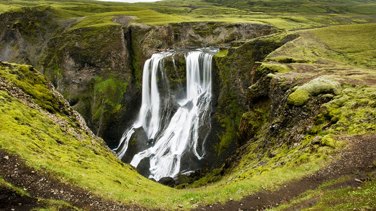
While Svartifoss is a well-known waterfall within Vatnajökull National park, the trail leading to it is a popular one and can get busy during peak season. Perhaps that has a lot to do with its striking beauty; after all, this impressive single drop falls is flanked by remarkable basalt columns. Regardless, though this is a must-see location, if you’re looking for something a little further off the beaten track this isn’t it. Instead, seek out others; in this article we’ve rounded up a few of our favourites, all of which are located within easy reach of Fjallsárlón.

Magnúsarfoss
Though you perhaps wouldn’t call this waterfall a secret, it is frequently overlooked by visitors. That’s because you skirt round it on the way to Svartifoss and in the haste to reach this beautiful landmark, Magnúsarfoss gets little more than a quick glance or a hurried photo from passing tourists.
Yet it’s worth a bit more than that. It’s about ten metres high, small by Icelandic standards but still significant. You can view the waterfall from the east and the west banks; in summer the latter can be obscured by greenery and you’d need to position yourself closer to the edge to see the cascade. As for Magnus, nobody knows who he was.

Hundafoss
Hundafoss means Dog Falls; its name references times in the past, when the swollen water might have swept away farm dogs in the vicinity. It’s more than twice as high as Magnúsarfoss, measuring about 24 metres from top to bottom. In fact, that actually makes it taller than Svartifoss too, though it lacks the drama created by its neighbour’s basalt amphitheatre.
Like Magnúsarfoss, the circular trail loops back through the area ensuring that you have a great view from both sides. Here, the east bank can sometimes fail to live up to expectations as you only get a side view and in summer it’s shrouded by vegetation. That means the colours really pop in autumn, though the trail can get a little slippery after rain. Nevertheless, it’s little more than 1.5km from the car park so there’s no excuse not to make a stop here.

Múlafoss
Múlafoss – the name means Mule Falls – is a highlight of any hike within the Múlagljúfur Canyon. This 101 metre high waterfall is the spectacular reward for anyone tramping up from the car park; though it’s only a short drive from Fjallsárlón you’ll need to factor in time for the walk as well.
Perched on the Rótarfjallsá River, the source of the meltwater that flows down into the canyon is the Öræfajökull glacier. Múlafoss actually descends in a series of distinct steps, not uncommon in Iceland, the largest of which is about 53 metres long. You can’t see them all, but what is visible is definitely worth lacing up those hiking boots to see for yourself.

Hangandifoss
Hangandifoss is the other of two significant waterfalls at Múlagljúfur Canyon, located relatively close to Fjallsárlón in the southern reaches of Vatnajökull National Park. Despite its remarkable height – the waterfall plunges about 130 metres down into the gorge below – the need to hike 2km to reach it means it remains a secret to many visitors.
If you’re keen to see this waterfall at its most impressive, you should aim to avoid colder months. This is because Hangandifoss sits on the Hangandifosslækur, which is a stream that’s fed by meltwater from the Öræfajökull glacier. This means that in winter, much of the discharge is held back as ice and the flow is significantly reduced.

Morsárfoss
Morsárfoss is Iceland’s highest waterfall, knocking Glymur off its pedestal and boasting a magnificent drop of 228 metres. This remarkable waterfall is situated in the western part of Vatnajökull National Park and is the result of a single flow of meltwater originating from the Morsárjökull glacier.
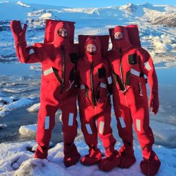
It’s a jaw-dropping sight and worth making the effort to visit. However, that’s not for the faint-hearted. You might choose to hike to the Kristinartindar peaks on a trail that leads from Skaftafell, but it doesn’t get you very close. To get anything more than a distant view, you’ll need to sign up for a guided glacier hike – with crampons, helmet, harness and ice axe necessary to keep you safe.

Picture by Jón Hartmannsson
Núpsárfoss and Hvítárfoss
You’ll encounter Núpsárfoss, a highland waterfall, where the Núpsá and Hvítá Rivers meet. The waterfall owes its existence to a glacier called Skeiðarárjökull, which covers Iceland’s most active volcano, Grímsvötn. Jökulhlaups are common, glacial outburst floods which cascade with immense force. Hvítárfoss, is also visible from Skeiðarárjökull; together with Núpsárfoss it forms a plunge pool called Tvílitahylur.
Núpsárfoss is characterised by great variations in the volume of water. Though the discharge isn’t as large as it was a century ago, it’s still significant which means that often its impossible to tackle the river crossings required to reach it – simply too dangerous, even in summer. Make sure you are completely certain that conditions are suitable before attempting to drive towards this waterfall.

Picture by Jón Hartmannsson
Fagrifoss
While Fagrifoss isn’t strictly speaking within the national park, it lies very close to it so we have included it in this roundup. It’s located on a rough highland road on the way to the Lakagigar Craters and it’s this challenging F-road – the 206 – which is the reason why it is relatively overlooked despite its extraordinary beauty.
If you’ve successfully navigated the river crossings and bumpy terrain to make it up here, you’ll see that Fagrifoss is located on the Geirlandsá River. Surrounded by verdant slopes, the water cascades down a drop of about 80 metres; you’ll be pleased to learn that there’s a car park, toilet and viewing platform here.

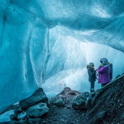
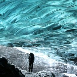
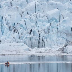
Falljökull
With all the ice around in Vatnajökull National Park, it seems fitting to end with an icefall. The Falljökull is a popular ice climbing destination as this glacier tongue is a breathtaking and steep frozen cascade. It’s located west of Fjallsárlón, overlooked by Iceland’s highest peak Hvannadalshnúkur.
As with many ice hikes in Iceland, access is by super jeep. To reach Falljökull you need to travel along an old farm track and then complete the rest of the route on foot. While it’s not a waterfall, the ice here is moving even though it appears to be stationary, so it’s effectively a frozen waterfall – and an extraordinary place to visit.
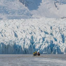
As at glacial lagoons such as Fjallsárlón, the secret waterfalls of Vatnajökull National Park form incredible landscapes that reward travellers who seek them out. The protections that come from national park status should ensure that the impact of tourism can be managed successfully, ensuring that we can visit these spectacular places for decades to come and still be awed by their beauty.